Onboard & equip.
Set up your organisation and register your drones and SkyTag tracking devices.
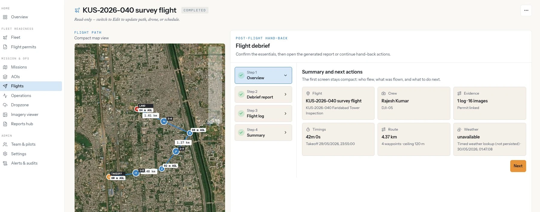
Plan safely.
Design missions and flight paths with terrain-following, airspace checks, obstacle clearance, and battery-range validation.
Operate live.
Track every aircraft on a 2D/3D live map with real-time telemetry, alerts, and airspace overlays.
Stay airworthy & compliant.
Monitor aircraft health from sensor telemetry, track permits and document expiry, and enforce governance rules.
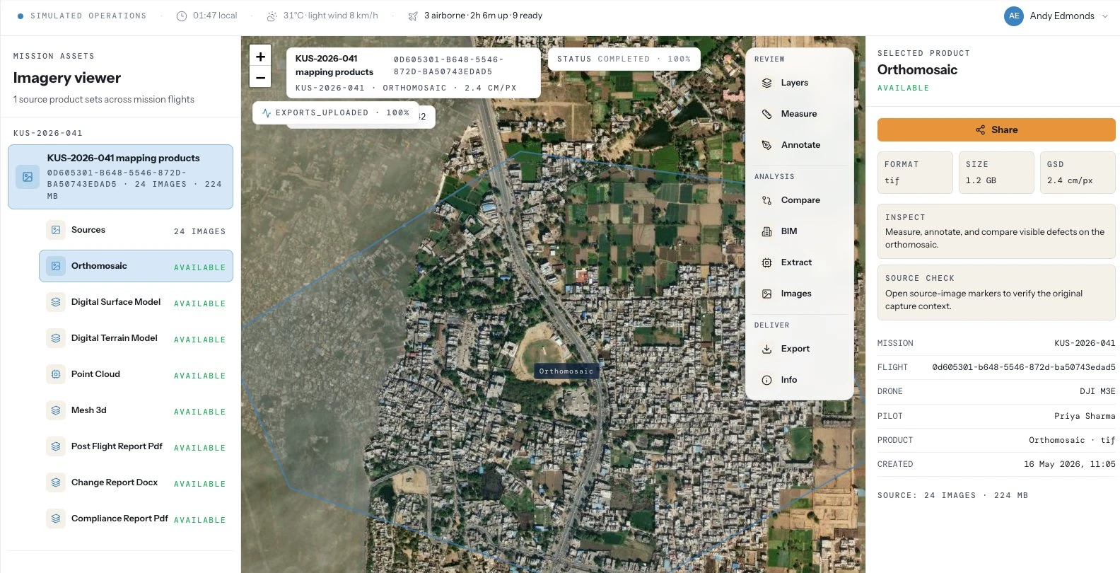
Process & deliver.
Turn captured imagery into orthomosaics, elevation models, point clouds and 3D meshes, run change detection, and package professional reports.
Bill & share.
Meter usage, invoice projects, and deliver access-controlled reports to clients via secure links.